Ever wonder how Minnesota got its shape? Well, wonder no more. When it comes to the shapes of states, Minnesota is one of the weirder ones. Specifically because it has an odd little tuft of land on the northern border with Canada. Ever wonder how that happened? Let’s find out.
Northern Boarder

Northern border. Arrow shows where Pigeon River empties into Lake Superior.
The northern border is Minnesota’s most goofy border. Basically in 1783 some negotiators from the U.S. and U.K. were trying to determine the border between Canada and the U.S. They basically said:
Okay, the northern border should be an all water route from Lake Superior to the northwest corner of the Lake of the Woods. Pigeon River is the only such thing, so let’s use that. Once we get to the northwest point of the Lake of the Woods we’ll go straight west to the Mississippi River. Sound good?
Only problem was they used an old, inaccurate map which showed the Mississippi River to the west instead of the southeast where it actually was. Anyway, 35 years later another surveyor came along and said:
Okay, no big deal. From that northwest spot in the Lake of the Woods, let’s just go straight south to…hmmm…how about the 49th parallel and then go due west until the ocean. Sound good?
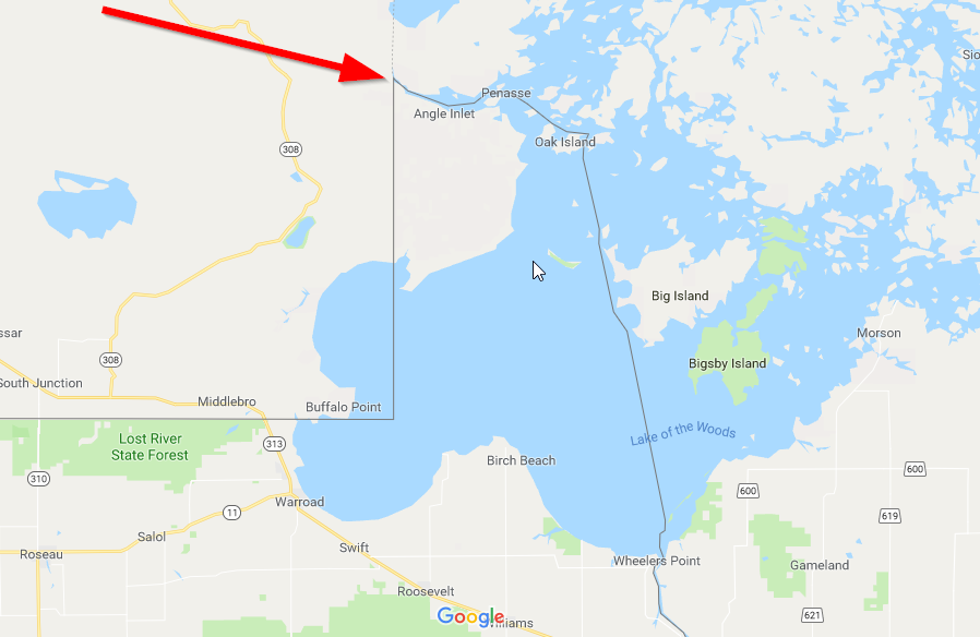
Both Britian and the U.S. agreed and called it a day.
Southern Border
The southern boarder was determined when Iowa was admitted as a state in 1846. Most Iowans wanted the longest part of their state to be the distance from the Missouri River on the west to the Mississippi River on the east.
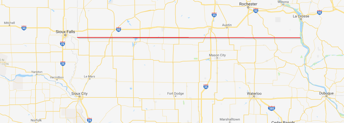
Interesting fact: before settling on this border, many Iowans wanted a northern boarder closer to St. Paul!
Eastern Border
Minnesotans like to give Wisconsinites a hard time, but when it comes to how Minnesota got its shape, specifically the eastern border, Minnesota owes Wisconsin its dues.
In 1846 Wisconsin was ready to enter the Union. Folks in Stillwater and St. Paul didn’t want to be part of Wisconsin, so they requested the border be further east. Wisconsin expansionists wanted a bigger piece of the pie, more of the land to the west. The government decide to split right down the middle.
So at basically the tip of Lake Superior, the border runs due south to the St. Croix River and follows it to the Mississippi River.

Western Border
In 1856, territorial delegate Henry M. Rice decided the border should basically be the one we all know and love today. He was concerned with getting the state into the Union so he lobbied hard for the border to run along the moderately north/south Red River.
Once it split, thus creating the Minnesota River, the border extended due south to the Iowa border.
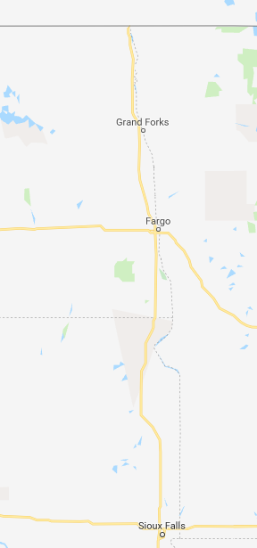
There you have it, that’s how Minnesota got its shape! Next time someone laments about why Minnesota looks so goofy, tell them it was a negotiating error based on an incorrect map.
If all this cartography and geography have made you even more excited to be a Minnesotan, head over to our shop and find some Minnesota gear to sport.
